July 2013 marks the 150th anniversary of the Civil War’s Battle of Gettysburg. There has been a great deal of preparation to commemorate this event, and last September (2012), I heard the following brief story on National Public Radio (NPR) Morning Edition:
Good morning. I’m Steve Inskeep. This may be the closest you can ever get to owning your own Civil War battlefield. Generations of tourists saw a map at Gettysburg, Pennsylvania – 29 feet on each side laid on the floor. This relief map features electric lights to show the battle. The Pittsburgh Post Gazette says after building a new visitor’s center, the National Park Service is auctioning off the old map. Not one person has made an offer, though bidding started at $5.
What? I was shocked! The Gettysburg electrical map was for sale? For $5.00?
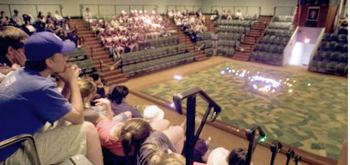
The electrical Gettysburg Map had been the highlight of our family vacation to Gettysburg Battlefield National Park in Pennsylvania in 1970. The Visitors Center’s map covered a huge portion of the floor and the electrical lights depicted troop movements during the three day battle that had raged in and around the small town of Gettysburg, Pennsylvania,N from July 1–3, 1863. Different colored lights separated the positions of the Union Army of the Potomac from the Army of Northern Virginia. We watched the lights change and understood how the generals manuvered their troops during this turning point of the Civil War. My father had paid the admission, an unusual treat, so that we could watch the lights on the topographical recreated hillsides flicker as they had in the evenings that hot July. Countless tourists had also paid to see the electrical map before it was retired in 2009, packed up, and indignantly placed on the auction block. As I listened to the NPR story, I thought that putting the map up for sale on EBAY seemed an anathema.
My family had camped for two nights that summer at Gettyburg, our campfire mimicked the lights of campfires that had lit the late night troop encampments a century earlier. The Carpenter’s rendition of “Close to You” had played on the car’s radio repeatedly during the day, but at night, when my father strummed “When Johnny Comes Marching Home” on the guitar, the area seemed haunted as we imagined the lives of the soldiers who took part in the deadly battles of the Civil War.
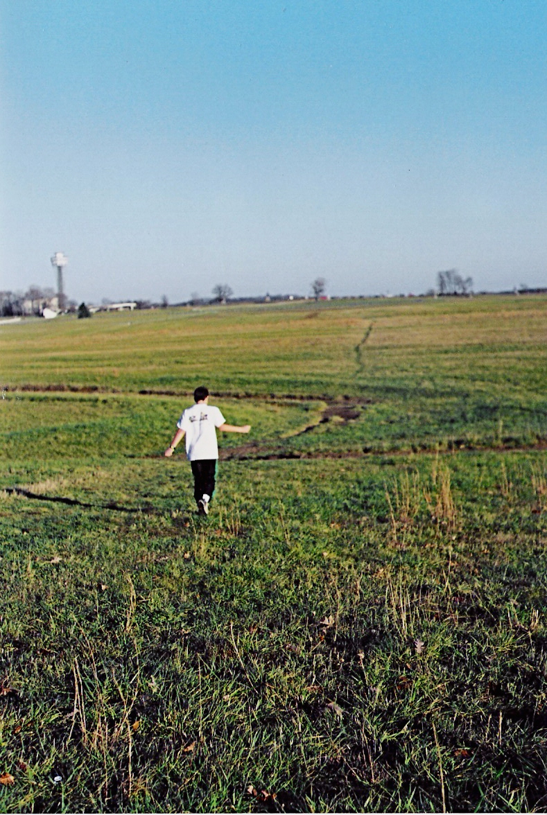
By day we travelled from monument to monument in our ’68 VW van. When we arrived at Seminary Ridge, we saw the expanse of fields where Major General George Pickett led his troops the last day of battle. Because of the electrical map, we knew exactly what had happened to the soldiers who had advanced under heavy fire from the Union’s artillery. We tumbled out of the van and ran out into the field, imitating Pickett’s Charge, the high-water mark of the Confederacy. We fell as so many soldiers did in that last ditch effort to break through the Union Army’s lines.
Walking Pickett’s Charge…
or standing at Pickett’s Charge.
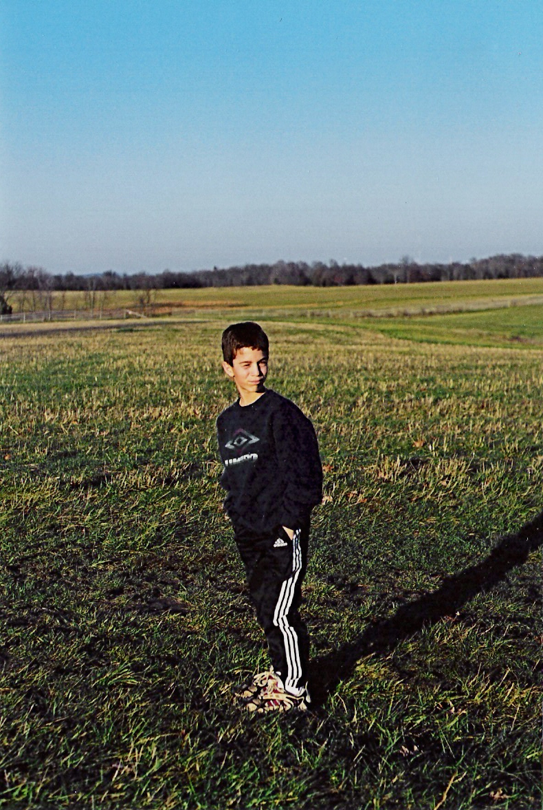
Years later, I took my own two sons to Gettysburg, and I tried to have them rush the field, recreating Pickett’s Charge just as my family had done years earlier. Instead my sons casually walked out into the open.
“Come on!” I encouraged, “You have to run to charge!” But they would have none of that behavior.
Discouraged, I walked them back to the car.
As I closed our car door, a van drove up into the parking lot next to us.
A tumble of bodies spilled out of the side door; several boys and girls raced out from the parking lot.
“Pickett’s Charge!” they yelled out in unison and were soon sprinting out onto the field.
“You see?” I turned to my boys who watched dumbfounded, “That’s the family I want to be with!”
My boys did love the electrical map, however, seeing the lights in action. When we returned home, they were inspired enough to build a map of their own. Listening to the NPR report, I grew concerned. If the map was not sold on EBAY, would it be destroyed? What could possibly replace such inspiration? Apparently, I was not alone with my concerns. When the map was dismantled and placed in storage, a website Save the Electric Map sprang up. There are pages were people posted their own memories of their visits. The history of the map, additional photos, and petition forms to save the map (and to drop admission fees) are also linked on the site.
Happily, the map was purchased for a little over $14,000 in October of 2012 by another map enthusiast Scott Roland. He has enlisted the help of the Gettysburg Campus HACC college student volunteers to complete the necessary electrical updates and controller programming. The Hanover Evening Sun reported on 6/14 that the map will again go on display for visitors. The article Electric Map Owner Partners with Gettysburg HACC Students for Renovations had an interview with Tom Lepp, mechatronics instructor in the industrial technologies department, to explain how the repairs will be made:
“The decision was made to refit the map with new electrical components rather than repair the existing wiring and lights due to the condition of the existing components, which are over 50 years old. The electrical system also suffered significant damage when the map was sectioned for removal and throughout the process of moving. This left the aged wiring in need of serious repair and damaged a number of lights. The original lights are difficult to service, repair, and source parts for. Many lights and lenses for lights are severely damaged or missing. The replacement lights, while providing ease of service, will preserve the aesthetics of the original lamps.”
There will be other families on summer vacations who will sit around campfires after touring the Gettysburg battle sites. There will be other families who will spill from their cars and spontaneously recreate Pickett’s Charge. And I am happy to report that the Gettysburg electrical map that was rescued from destruction will continue to illuminate the troop positions and visually tell the story to future generations so they may better understand the significance of this battle in our nation’s history. You will still have to pay an admission, but these memories are priceless.